Drone Photogrammetry
Dempers and Seymour provide drone photogrammetric mapping and pit inspection services, allowing for high-resolution data to be collected.
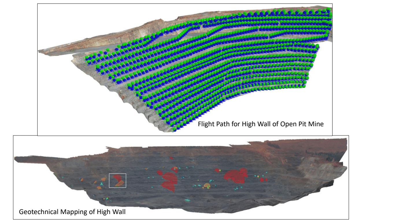
A complete survey of a pit can be undertaken in significantly less time and cost, with superior quality and quantity of data, when compared to traditional mapping methods. The drone allows for surveys and structural mapping of inaccessible areas using a pre-planned flight path allowing for rapid collection of high-resolution data.
A single operator collects remote geotechnical data from a safe location, replacing the requirement for physical mapping and eliminating exposure to hazards. The drone operates at altitudes such that pit operations can continue while the survey is being conducted.
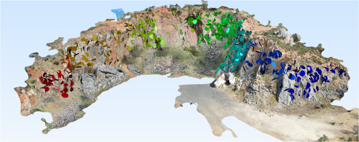
The photogrammetric data is used to create 3D textured meshes of the pit walls that allows for defect planes and significant large-scale structures to be identified and structurally mapped. The structural mapping is then interpreted allowing for structural analysis, kinematic analysis, back analysis of previous failures and limit equilibrium analysis.
The methodology can also be used for any large-scale excavation with limited access for example inactive quarries, road cuttings and cliff faces.
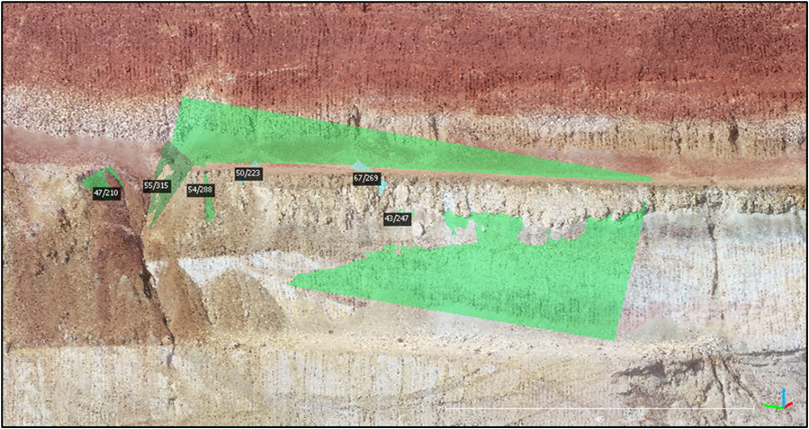
Structures Above Existing Failure on Haul Ramp
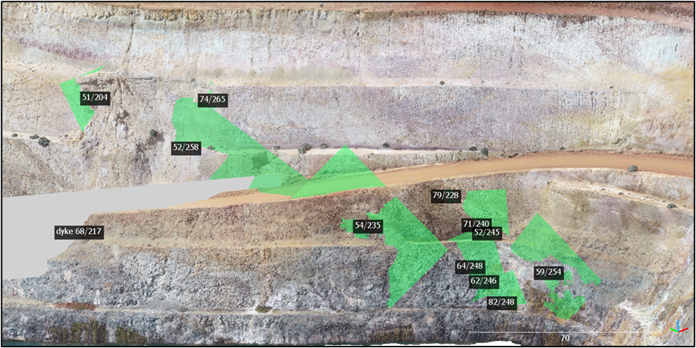
Sub Vertical Structures Intersecting Haul Ramp
Geotechnical Structural Mapping for Proposed Portal Position
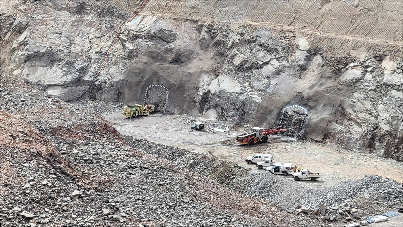
Initial Portal Development
Initial Portal Development
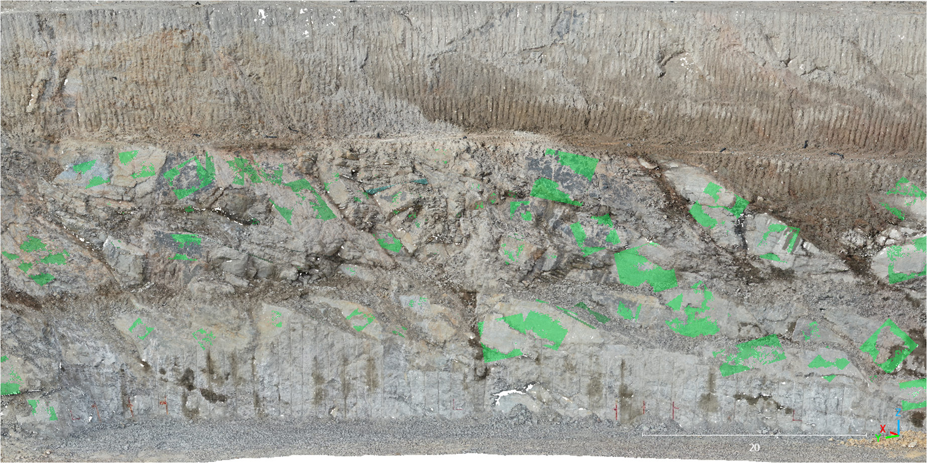
Inactive Quarry – Hazard Identification
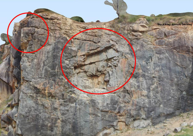
Potential Zones of Instability
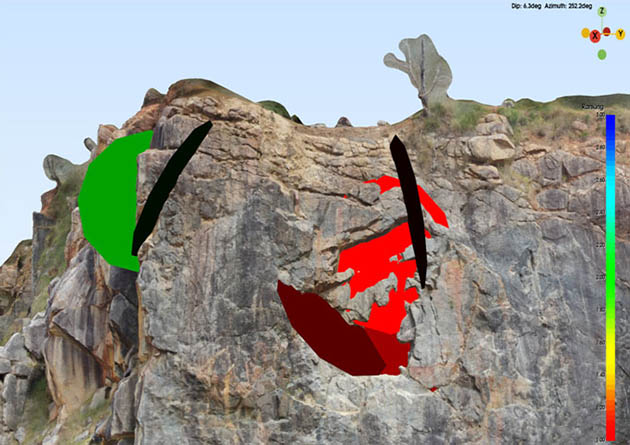
Potential Failure Planes